Feeds:
Posts
Comments

Archive for February, 2012

Tour de Bear

Bear Peak being my favorite summit above Boulder, I decided to hike back up a week after Tara and I did it from Shadow Canyon. This time I decided to head up the steep Fern Canyon Trail and descend west and north into Bear Creek for the return journey. I stopped and played with a tripod and a couple lenses when I first hiked by Bear Creek.

Yaktraxs were definitely needed on the icy Fern Canyon Trail even if the south-facing slopes across the canyon looked dry.

Green Mountain’s best side was definitely in view from this angle.

Old wood textures and colors allowed an excuse to stop mid-ascent.

I was granted plenty of solo time on the summit.

A series of black & white images stalked my descent down the west ridge and into Bear Canyon.

I eventually lost the gray tones in all the creek crossings as I got further down the canyon.

The views of Dinosaur Rock and its flatiron neighbors had me thinking about coming back for a sunrise photo some day.

I certainly wasn’t done with the snow, but it had a few surprises for me. Like this snow roller that melted out into a small arch.

Instead of immediately returning to NCAR, I followed the Bear Creek trail to some muddy loop around and back to the trailhead. It did provide another opportunity to get a long-exposure/blurred water shot of the creek.

Complete photo album

Read Full Post »

Sunday Tara and I went out to see how much snow had melted from the storm 2 weeks ago in the hills above town. Answer: not much.

From the South Mesa trailhead we found lots of mud and well packed snow on the Towhee trail on the way to Shadow Canyon.

Once in Shadow Canyon Yaktraxs proved useful in keeping uphill momentum on the packed snow. The trail to South Boulder Peak was less packed and the softer snow was more of a traction challenge. However, the summit was ours alone excepting a glider circling above making ominous metal noises (flaps and rudders?).

After a short backtrack we headed to neighboring Bear Peak to scramble to the summit before the slick descent back to the trailhead.

Read Full Post »

Thatchtop

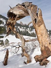
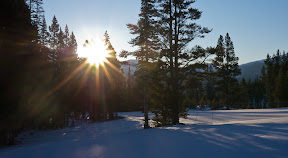
Pete, Jason and I left the Glacier Gorge trailhead about 6:30 am, just light enough not to need headlamps. While heading up to The Loch we had a few views of the #1 peak in Rocky Mountain National Park.

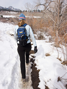
Since I hadn’t been up here in winter before, I navigated us onto the summer trailhead where we had the pleasure of breaking new trail. Note to self – follow the beaten path in the creek bottom next time.

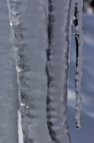
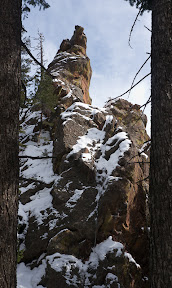
The sun was illuminating the rocks above us at The Loch, but on the frozen lake it was still cold and windy.

We followed an old snowshoe track out of The Loch and towards Andrews Glacier but it quickly ended. The effort in laying a new track through knee-to-crotch deep snow was exhausting and a couple “whompfs” of the snow pack convinced us that heading towards higher-angle terrain was a bad idea.

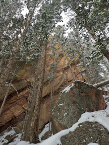
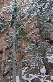
On our retreat back to The Loch we discussed alternate plans including moving to the Bear Lake trailhead and attempting Flattop. Once we reached the frozen lake we spent some time looking at the towers and gullies on Thatchtop’s north side and decided to find a way up that peak via the broad north ridge.

“Skating” across the ice in our snowshoes we made for Thatchtop and what looked like a low-angle and snow-free route through the cliff band.

As we climbed up a bit a view of Taylor Peak (one of our original objectives) emerged.

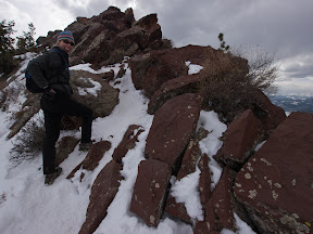
After fighting through some loose rock fields we reached our gully.

A quick scramble got us into the gully proper.

I found myself wishing for more snow, as the gully was composed of very loose rock which we could only partially avoid by scrambling on the left side rocks a bit.

The gully faded into a broad slope that was no-less loose but at least not as steep.

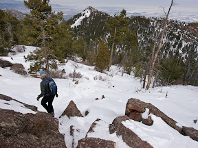
Eventually we emerged onto more solid ground and reached the sun’s warmth.

The summit was still about 1,600 feet above us, and the terrain was maddeningly the same – uneven rocks (some loose) and patches of snow (some a supportive wind crust, others dry powder). At least the winds were mild for a winter day near the continental divide (gusts about 30mph).

While we were rewarded with views of Longs Peak occasionally, all of us were suffering a bit. I hadn’t been this high since maybe August was was certainly feeling the elevation. Jason was operating on a hour of sleep. Pete was probably doing the best of all of us, having been to the summit of South America (Aconcagua – almost 23,000 feet) last month.

Around 12:30 we finally reached the summit and were rewarded with some magnificent views. I’m often reminded that the best views aren’t found on the highest peaks.

After enjoying the somewhat cold and windy (but for winter time not too bad) summit we returned the same way, somewhat quicker but still feeling beaten up by all the uneven terrain. A little help from our GPS and we found our snowshoes and other extra weight we’d cached above the cliffs then made our way back through the steep and loose.

Once we made it back to The Loch, we took the easier and more packed trail down the creek valley and returned to the trailhead after a 9 hour day. Food and beer were eagerly consumed after a 90 minute drive back to Boulder where we helped celebrate “Stout Month” at Mountain Sun.

Complete photo album

Read Full Post »

Mallory Cave Trail

After skiing in the new snow up in the mountains on Saturday, I returned to Boulder’s week-old snow for a hike up the Mallory Cave Trail.

Unlike last week’s deep snow hike up Green Mountain, today the trails were well backed until the very upper reaches of the trail.

Many of these formations are ones I’ve scrambled up before and seeing them again had me looking forward to a warmer season when I’d be able to climb over dry rock.

As a hike the out-n-back is less than 3 miles but takes you closer to more rock formations than maybe any other trail in the flatirons.

Read Full Post »

Breckenridge

I was originally planning to snow camp Saturday night, but after our somewhat arduous day hiking Green Mountain, I drove up to Breckenridge for dinner at the brewery with my dad and brother. I did drag along my -20F sleeping bag and spent the night sleeping out on the deck. After a cup of coffee and slice of bread, I gathered my layers and skis and walked to the base of the ski resort’s Peak 9 for the start of a 2,000 foot skinning session.

Sunrise caught me partway up the mountain.

I wasn’t feeling as strong as normal (maybe yesterday had something to do with that) so it took me about one hour, fifteen minutes to reach the top of the Mercury lift. I hadn’t skied since last winter/spring, so my first turns were pretty sad – thankfully no one was out to see me but a lift operator or two. My technique settled down and improved by the time I reached the base and then I went in search of a more substantial breakfast.

Afterwards I wandered over to the Riverwalk center to check out this year’s snow sculptures (they were completed last weekend, and several had fallen or seen the effects of the sun).

Read Full Post »

Green Mountain

With roughly two feet of snow in the last 36 hours I knew Tara and I were in for a bit more than we’d counted on when we stuck with our plan of hiking up Green Mountain.

A few people had been out during and since the storm, but Gregory Canyon certainly wasn’t a well-packed trail.

A few flakes continued to fall from the sky, but our biggest impediment to staying dry was the random zephyrs that cleared trees of their snow load.

We took a breather near the Realization Point/Ranger Trail junction where the trails got more serious about gaining elevation.

By the time we reached the 4-way trail junction just west of Green Mountain’s summit the snow was nearly 3 feet deep and the trail much less traveled. We were rewarded with a bit of sunlight however.

It had taken us about 3.5 hours to reach the summit and we didn’t stay long at all. The much shorter (and more traveled) Saddle Rock trail provided us a descent route.

The most rewarding views came lower down as the backsides of the First Flatiron and the Sunset Flatironette came into view.

The descent went much quicker, only 1.5 hours, but we had to be much more careful with our footing and tired legs.

Complete photo album

Read Full Post »