Our backpack would begin near the Boulder Airport in Utah. Airport security failed to confiscate our liquids (water and bourbon) and even more spectacularly failed to keep us off the runway.

I left Paul and our backpacks at a Starbucks near the international terminal (read: in the middle of nowhere) and drove a dozen miles down the highway to the Escalante River where I dumped his Jeep in the reeds and started to walk and hitchhike back up the road. A lovely lady from Holland traveling with two toddlers picked me up and cut my walking dramatically. My own country men couldn’t be counted on today to help a fellow out.

By noon we were clear for departure and started down the Boulder Mail Trail. Early pinion and juniper forest gave way to slick rock hiking as we neared the Sweetwater/Sand Creek drainage.


Somewhere around here we crossed paths with an old telegraph line which became fodder for many jokes at the expense of AOL forums.


Before diving down into Death Hollow itself, we took a side trip up a stone knob for an amazing view into the upper canyon.

Back on the Boulder Mail Trail we followed it to a cairn placed on the edge of the earth, before following the carved out ledge that we carefully followed down into the canyon.


On the way down we passed two hikers, they’d be the last people to see us enter Death Hollow. We decided to skip the first campsite we saw and hunt for something better. The first of numerous creek crossings quickly came up so we switched to sandals and survived our Death Hollow initiation.

Luckily for us we located camp right at happy hour. Which meant the bourbon load would weigh less on our shoulders tomorrow. Which meant we could hike faster and eventually get back to civilization about the time the bourbon ran out. I love it when a plan comes together.

Normally I might sleep lightly in a canyon where flash flooding can be a major concern. However, our forecast looked clear and Paul assured me that his tent was rated for debris flow.
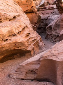
The next morning we woke looking forward to the highlight of the 3 day trip – our passage down Death Hollow through some narrows and beautiful scenery.

The temperatures were warm enough that we quickly stopped trying to rock hop across every bend in the stream, and took to wading liberally in the creek in our sandals and neoprene socks. A few long wading sections we discovered were due to beaver dams.


After quite a few creek crossings and much dodging of poison ivy we came to our deepest crossing of the day. I volunteered to scout it out sans-pack, and found the muddy water to be only mid-thigh deep. All our other crossings had been knee-deep or less so far.


Around noon we stopped for a lunch break somewhere – neither one of us had really been paying enough attention to the map to know exactly where we were at this point. Our navigation was pretty easy, just head downstream.

Shortly after lunch we did cross a big side stream which I figured was Mamie Creek. Below this point Death Hollow would get narrower and the rains from 2 weeks ago would decide just how hard our passage would be.

We’d already found a couple trash bags, tossed around in the recent flooding but surprisingly intact and filled with sand. We’d dug those out and packed them out like good LNT hikers. But when I came across two blue external frame packs that was a bit much to pack out. We could have helped our selves to a sierra cup and spork, but left those items with the pack thinking that scounging anything from this bounty would be bad juju.

The first real waterfall in the canyon soon presented itself, so I broke out the tripod and 10-stop filter for a long exposure.

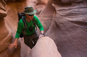
Half wading, half balancing on a narrow shelf we passed through the following narrows section.

We managed to get through without slipping into the deep pool of water and testing our dry bags.

Hiking the rest of the canyon was a little more enjoyable knowing we’d passed through the one area that could give us the most trouble already. And there was certainly plenty of Neature left in the canyon, including water snakes and water ouzels.


We hit the junction with the main Escalante perfectly for happy hour (this is becoming a habit). We found a perfectly flat campsite on a sandy bench surrounded by cottonwoods and investigated a nearby set of pictographs. We also madea point of pulling our drinking water from Death Hollow as it was much clearer than the muddy Escalante.
We may have been two days out and hadn’t seen another soul for more than 24 hours, but don’t let that fool you. There was certainly an element of glamping, after all, we had two fine bourbons to taste and Paul whipped up some salmon croquets for our dinner.
However, the glamping theme was a little put out by the wind and cold that came in as we cooked our croquets. And next morning’s cold wade across the Escalante for more of that Death Hollow water was bracing. But by 9am we were off and headed down canyon. Before too long we heard a chainsaw and came across a volunteer crew out removing invasive tamarisk trees from the canyon. The Escalante had also seen a lot of flooding two weeks ago and many debris piles had be to dodged as we bushwhacked between the creek and the higher banks.

We ran into some day hikers just as we reached the significant landmarks of this stretch of the Escalante – the Escalante Natural Arch and Bridge and some Anasazi ruins.


After this trip and our spring visit to Grand Gulch we were starting to formulate our own theories of the Anasazi’s defensive cliff dwellings and sudden disappearance. I’ll share just two words with this readership while we wait for our peer-reviewed article to find a home in the appropriate scholarly journal: zombie apocalypse.

The last two miles were fraught with dangers as we had nearly emptied the last of our flasks and wondered if we could make the town of Escalante before going dry. Fortunately, Paul’s Jeep remained where I’d left it 2 days before and crisis was adverted.

Read Full Post »


