Feeds:
Posts
Comments

Archive for April, 2012

Our final day in Utah started in Capitol Reef National Park with darkening skies.

Deciding to avoid any long hikes we took a tour up the Scenic Drive and rested tired legs by staying close to the truck.

Back at the Fruita settlement we stopped to check out the orchards, blacksmith shop and petroglyphs.

We made one final stop to stretch our legs with a visit to Goblin Valley State Park.

Complete photo album for Capitol Reef and Goblin Valley

Read Full Post »

Grant’s trusty truck took us from Boulder, UT along the beautiful Barr Trail (hats off to the Long Canyon) and into the southern spur of Capitol Reef National Park. There we bounced a couple miles to the 4WD parking and set off for our second hike of the day – the Upper Muley Twist Trail.

Cool temps and wind pushed us along the dry wash. While not as bad as the deeper sands going into and out of Coyote Gulch, we were both missing a firm trail surface by this point.

The drive in had shown us a couple arches and now the hike through the wash was delivering 5 more. Still, at this point in our trip we’d seen enough arches that we were left wanting something a little more.

We partially explored a side-canyon or two but didn’t dally much as the weather had been looking unstable all day.

Following the cairns we left the canyon bottom for some slickrock hiking on a bench above the valley floor.

After hiking around the pour-off that the trail avoided we returned to the creek bed for only a short time before heading up to climb the white rocks above.

Hiking on the white rim of rock above the wash quickly became our favorite part of the trail. The views of both the Waterpocket Fold to the east and the Muley Twist canyon to the west were stunning and I only wish we could come back and hike this trail in the early morning when sunlight would pour onto the red rocks.

A few sections of the trail were very close to some exposed cliff edges and had a bit of scrambling that I hadn’t expected from this hike. I also hadn’t expected to get snowed on, but never discount a Friday the 13th for some strange weather – even in the desert.

Eventually the fun had to end and we returned to the valley floor to retrace some of earlier wash-walking back to the truck. The rest of the drive out through the Waterpocket Fold in late evening light was spectacular as the storm had moved on.

Complete photo album for Upper Muley Twist Trail

Read Full Post »

Under cloudy skies with an expectation of snow we left Escalante for the Calf Creek Recreation Area and Calf Creek Trail.

A very popular 6 mile round trip hike takes one past a couple granaries and pictographs to a spectacular falls.

We were early enough on the trail that we passed one other group then had the rest of the outbound hike (and the falls) to ourselves.

The falls were definitely the main attraction.

On the way back to the trailhead we passed all the hordes hiking in and were glad we’d gotten an earlier start.

Our next stop was Capitol Reef National Park, but the drive through Boulder, UT showed just how cold it had gotten.

Complete photo album of Calf Creek

Read Full Post »

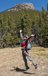
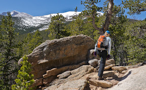
Puttering along in first gear we babied Grant’s pickup out the Fortymile Ridge road to keep a mismatched fan from allowing the radiator to go super-nova. Eventually, we reached the end of the road and finished stuffing our backpacks while the wind grabbed anything it could and attempted to make off with it. From the trailhead the route managed to follow deep sand while avoiding the perfect-for-walking rock slabs on either side. Slowly the accumulated sand took over our shoes and when we hit some rock it was time for a spring cleaning.

After some more sand trudging and a game of follow-the-cairn across rockier paths we reached the Crack-in-the-Wall that would allow us to descend to Coyote Gulch, a side canyon of the Escalante River.

Sitting tight for a minute we allowed another group to come out of the narrow slot before we squeezed through the sandstone wringer.

An easy downhill sand slope took us by some great formations and right to the stream of Coyote Gulch.

Dropping our packs we set out for the short distance down the creek to the Escalante.

Just before reaching the larger river, the wind picked up and brought rain with it. Deciding it was best to be back with our gear, we turned and retreated. Picking up our packs we headed up canyon for a little ways before finding a campsite with a small sheltered overhang to wait out the weather.

Grant’s pack had suffered some damage to a frame stay during the squeeze through Crack-in-the-Wall so we gathered some sticks and used up our tape splinting the broken carbon fiber stay. Hopefully, we wouldn’t later miss any of that tape for ourselves!

Clearing weather sent us on a short ramble where we got to see Steven’s Arch in the best light yet.

The next morning we packed up and headed up canyon passing several small seeps and waterfalls.

The first big formation was Cliff Arch.

Petroglyphs were the next stop on our Coyote Canyon tour.

The scenery just keep getting better as we reached Coyote Natural Bridge.

Unmentioned in the guidebook was a cool section of narrow water-carved walls and some short falls that we dubbed the “sluiceway”.

By now Grant’s Chacos straps had torn and he took up barefoot walking through the stream as we neared Jacob Hamlin Arch. Despite it’s size, I was underwhelmed by this formation after all the beauty we’d seen so far.

Near the arch is a 45-degree sandstone slab leading out of the canyon. On the recommendation of one guidebook I’d even brought along some rope to haul our packs up this section.

Unfortunately Grant doesn’t have a lot of climbing or sandstone scrambling experience and found it difficult to trust his running shoe-clad feet. After trying several variations we decided to play it safe and lower the packs and retreat back the way we’d come.

Much to our horror, that meant we had to walk 6 miles back down the canyon through all those wonderful sights. I could think of many worse places to have to traverse twice in one day.

The trip back took a lot less time as we knew the few detours from the stream bed and didn’t need to stop for so many photos. The section I wasn’t looking forward to was the hike back to the Crack-in-the-Wall, an ascent up loose sand. A few clouds and some shade eased the effort and we were soon squeezing through the crack and facing the wind for a bit of death-march back to the trailhead.

Once we reached the car our adventure wasn’t completely over as we found ourselves pressed into duty to help tow a Honda Accord out of the 4WD road and back to something manageable. At least the Escalante Outfitters came through with some cold beer, great pizza and cheap-ish cabin for the night. The shower was also a welcome luxury.

Complete Coyote Gulch photo album

Read Full Post »

As a compromise between a desire to get up high and the wind forecast, we settled on Estes Cone, a landmark in Rocky Mountain National Park a bit over 11,000 feet.

Yaktraxs were useful for the hike were plenty of tramped-down snow remained. As the trees thinned higher up the wind and sun had removed much of the snow.

Some recent dusting of the white stuff make Meeker and Longs look just a little more snow covered than when we were last up in this area.

The west-facing aspects of the Twin Sisters certainly showed the lack of snow this year.

Read Full Post »

For our final full day in the Needles district of Canyonlands, we decided to tackle the longer hike to Druid Arch from Elephant Hill. The approach drive on a dirt road was no problem and unlike the Squaw Campground Trailhead, there was plenty of parking. My biggest issue was staying cool in the warmer temperatures today and full sun as we hiked south through Elephant Canyon.

By the time we neared the arch I was feeling over heated and stopped at a small flow of water where some backpackers we’d run into the day before were stopped and filtering water. I soaked my t-shirt and we were off again to the arch.

We rested in the shade below the arch and I wolfed down several snacks to regain my normal pep.

Feeling better we hiked down the steep and loose rock from the base of the arch and back down the ladder.

Despite the heat, I was feeling better the whole way back to the trailhead.

For sunset we drove out to Pothole Point and admired the 360 degree view without seeing a single light from human habitations. In the morning we packed up camp and did a couple short hikes (Cave Spring, Roadside Ruin) as we drove out of the park with a bearing for home.

Complete photo album from the Needles

Read Full Post »

Camping so close to the entrance gate at the Needles District allowed me to get up early and drive into the park’s Squaw Campground and see who was leaving and pick up a freshly vacated spot for the next two nights. Breakfast was cooked at the Needles Outpost while breaking camp to move to our new digs. Once established we decided to hike from the campground to Chessler Park – a longer approach than the more normal route from Elephant Hill.

Some slickrock hiking with great views led next to a deep pool just off trail and then some hiking towards the Chessler Park Trail.

Once we reached Chessler Park we took a good look around then retreated to some off-trail shade for lunch. A curious raven was as interested in our snacks as we were.

We then reversed our earlier journey with a few extra stops. One to offer water and advice to group with a sick hiker and another to squeeze through a mini-arch just off trail.

Complete photo album from the Needles

Read Full Post »

Driving westward we eventually left Colorado and celebrated reaching our beehive-state neighbor.

We found Moab very busy this evening and rushed through town to secure one of the last spots at the Ken’s Lake campground. Back to town for dinner and supplies then we slept through our coldest night of the trip. The next morning we finished our drive to Canyonlands National Park, but discovered that the crowds had already taken all the campsites at Squaw Flat. Just outside of the park is the privately-owned Needles Outpost, where we took one of their last campsites before returning to the park for a loop hike of the Squaw Canyon and Big Springs Trails.

The scenery was gorgeous as I remembered from last spring’s trip, even if some of today’s hike included new trails for me.

Dark clouds looked somewhat threatening, so we were glad to reach the only section of slickrock scrambling to cross over a ridge and join the Big Springs Canyon Trail.

Our hike back went quickly and we returned to camp to rest and prepare dinner before sunset.

Complete photo album from the Needles

Read Full Post »