Feeds:
Posts
Comments

My most recent outdoor weekend started with a post-work trail run with Brad out of the Doudy Draw trailhead. We covered a semi-hilly 8 miles at a mostly conversational pace. Our main topic was the outdoor efforts we were planning for next year and how we could support one another in those endeavors.

Saturday I spent the day out-of-doors, but largely in my backyard as I built my first retaining wall to level out our side yard for a future garden plot. The work was a lot of fun and took me back to my days of regular trail maintenance and should be the first of many such projects.

And on Sunday I decided to metaphorically combine the prior two day’s activities by running and hiking a marathon on my first Boulder Trail Runners “Church Run”. The Church Runs are usually all-day affairs involving a lot of elevation gain. Today’s all-trail loops at Heil and Hall Ranches near Lyons were notable for being particularly runnable. The pace and elevation gain turned out to be perfect training for my Tecumseh Trail Marathon sweep role in a few weeks. Three of us (out of the original 8 runners who started) finished up the full distance for the day and with plenty of hydration and food I’m not sure we ever really hit the wall.

Hey Ranger!

Brad, Pete, Tara and I spent Veteran’s Day at Staunton State Park with a mixed bag of activities in mind. Tara took off for a trail run while Brad, Pete and I headed to Park View Dome for an easy multi-pitch route.

Hey Ranger! is a 3-pitch 5.5 route that most resembles a granite version of the 3rd Flatiron. Just my kind of climbing. While I’m still getting back into the proper head-space for leading, I decided to take the first pitch’s lead and felt pretty comfortable, despite the run-out first 30 feet.

Pete and Brad followed the pitch and while Pete racked up to lead pitch 2, Brad and I started to wonder where Tara was and Brad rapped down to hunt for her.

Pete did well on pitch 2, so I followed up and finished the route’s shorter and easier 3rd pitch to the summit where I built an anchor completely on chicken-heads.

We coiled the rope and took a short hike to find a rappel tree that lead to a descent gully between the Parkview and Ranch Hand Domes.

Tara showed up at the base of the climb and we soon found Brad waiting at a trail junction for us.

After all gathering up again, we hiked up to the Tan Corridor and Brad led Reef On It! a popular 5.10 sport route. Tara, Pete and myself each took a top-roped lap on the climb before calling it a day. It was my second trip to Staunton and I’ll have to come back just for a long trail run one of these days to explore more of the park.

Rattlesnake Ramble

The Rattlesnake Ramble trail run’s original 2013 race date clashed with the September floods that closed numerous mountain roads outside of Boulder, Colorado and Eldorado Canyon State Park. After the park re-opened the race was on for Nov 9th.

I had no particular race goals but to have fun and try to push myself to run a decent race. To that end I didn’t start out too fast and plodded along up the main road to the Fowler trail. I was keeping pace with a couple people including the first place woman and followed them on a couple passes on this first out-and-back stretch.

Back on the main road I threw my windbreaker under the aid station table as we went by and ran the road fairly steadily, pacing Bill Wright (race director) in this section. The big climb up the Eldorado Trail came up quickly and I did a little jogging through the lower section of this climb, passing a couple competitors and gradually my pace morphed into a power walk (Bill Wright’s pre-race announcements included a story of jogging this trail only to be passed by a hiker), jogging only a few of the less serious inclines. The lead runners were bombing down the hill while we made our way up but the climb ended earlier than I thought. Someone said “this is the top” and at first I didn’t believe them only to find myself running downhill on a short stretch to the turn-around.

I’m a fairly fast downhiller, so I let my legs reach a quick turnover while still trying to stay within my comfort range for the rocky terrain. Towards the bottom I got behind one slightly slower runner and had someone else on my heels. The three of us hit the bottom of the trail and wider road together and the fellow behind me passed both of us. I locked onto his pace and fell in behind and we pushed the pace down the dirt road for a mile towards the finish. Once again a third runner caught up and joined our pack and using the Bastille rock formation as a guide I launched an early finish-line sprint (Strava claims I hit a 4min/mile pace for a [very] brief moment).

My final kick lost steam with 50 feet or so to go to the line, but looking over my shoulder it looked like I had enough of a margin to coast in ahead of my two competitors. My run is posted to Strava for viewing. My run was good enough for a 25th overall finish and a time of 36:27.

Tara came in a bit later, feeling pretty good on her run and made the podium for the Masters Women division.

Preliminary results, a large collection of photos, and the race director’s report are posted online. The post race prize table was deep and full of runner/climber goodies. We even helped ourselves to a post-race donut (ssssh, don’t tell everyone else in Boulder!). There’s a good chance this event will make it onto our calendars for next year.

After the Moab Trail Half Marathon, Tara, Brad, Chris and I retired to Milt’s for lunch then repacked for an afternoon rock climbing at Maverick Buttress in Long Canyon.

Brad and Chris tag-teamed a lead up the 5.10 Saddle Sores while Tara and I top-roped after them.

Brad then lead up the neighboring route Texas Two Step and the rest of us top-roped the climb.

Then it was back to Moab where I realized why my climbing shoes had hurt so bad – I’d received a couple large blisters from the trail run earlier in the day.

The next morning Tara and I provided some support (mostly heckling) as Brad and Chris stuffed gear into dry bags and considered swimming across the Colorado River to access a short desert tower. After one aborted attempt without wetsuits, then another where swimming in a strong current proved a tough way to cross. We shuttled the wet climbers up river to a shallower spot.

This time they managed to wade all the way across the river below the Barney Rumble Tower which some interesting hiking, canyoneering and a little bonus pitch of rock climbing allowed them to access and climb.

Since they were now out of shouting range our job heckling was over and we drove on to the Fisher Towers for a beautiful hike.

Next time we come to Moab (for the 2014 Moab Trail Marathon?) we really need to make it at least a 4-day weekend.

For the first weekend in November, Tara and I traveled a slow and snowy I-70 out to Utah for some warm days in the desert. Our main goal was Saturday’s Moab Trail Marathon, of which I was facing up to my actual fitness level and moving to the half marathon course and Tara would be running the 5k for the 3rd year straight. I hadn’t run much for the week before the race, so my body should have been well rested, but I wasn’t feeling super strong going into the event. My “A” goal was to have a fun and enjoyable race.

So I guess it was good that I started in wave 3 of 5 and spent the first 4 uphill miles jogging well within my comfort zone, passing other runners who went out way too fast and generally settling in to my form and pace. Full race GPS track right here. Toward the later half of the Pritchett Canyon climb I started to pass more and more runners, especially on some of the steeper scrambling sections of rock. For the slight downhill into the first aid station from miles 4-5.5 I took it easy and ran with one or two others and chatted. A quick swig of sports drink and I started semi-hard on the rolling terrain that followed, passing quite a few runners, including one sporting a I believe in The Blerch tee.

Sometime between miles 6-9 I got frustrated with the number of runners I was having to pass on semi-technical trails until I remembered that I was the main problem, starting in wave 3 (which may have made sense for a half-marathon effort, but didn’t for my quicker half pace). I will say this course is beautiful, but technical enough that I didn’t get to look around and enjoy the scenery.

Coming into the 9.6 mile aid station I ran into Chris and Brad who were out looking for me and found themselves helping an injured runner descend some steep cliff bands. With their cheering I took another hit of sports drink, then turned right on the half course for a bit of a road climb that I ran semi-hard.

Our next bit of trail had us passing some mountain bikers (on a technical downhill that they were walking their bikes), then in and out of the Kane Creek (cold and mid-thigh deep in spots on me). With only a couple miles to go I was getting into full competition mode, the constant passing of other runners fueling my speed. The creek definitely slowed everyone down (it’s hard running on completely numb feet!), but as we moved out of the creek for the final road and last trail sections I started to push my pace even faster. I also got a little spiteful, picking out runners ahead and passing them for minor reasons (“he’s wearing tights, can’t let him beat me”, “that guy with the hipster ‘stash is getting passed”). Not entirely proud of this behavior, or the two ladies who I sprinted past in the last 50 meters, but the 2:13:16 time felt good for this technical and hilly of a course. This was also the US Trail Half Marathon National Championship, which I guess means my 138th place finish sorta means I’m the 138th best trail half marathoner in the country (if you can believe that). Full results right here.

Other than the cold creek crossings, this was a wonderful course. I’d certainly consider heading back next year and seeing if I can’t compete at the full marathon distance.

Staunton State Park is a recent addition to Colorado’s state park system and opened for (legal) climbing only last summer. With climbing limited around much of the northern Front Range due to last month’s flooding, Tara, Brad and I took a trip out 285 to check out the rock domes here.

Despite doing fairly well in an orienteering race the day before, I managed to get us started on the wrong trail and we got to do some bonus mileage on the way to Staunton Rocks. Armed with the free guidebook from Fixed Pin we found our way through the Tan Corridor and up to the Marmot Tower. The 5.5 trad route “Maybe the Marmot Ate Your Baby” was our warm-up goal. I took one look at the continuous crack system and felt a sudden desire to jump on the sharp end of the rope. I asked Brad for the rack and suited up much to Tara’s surprise.

Sure I over-protected the route, and fiddled in marginal gear from less-than-ideal stances, but I still felt pretty good for my first time leading in well over a year.

We played around on the neighboring routes: Baby Steps (5.9) and Shoes for Dessert (5.8+), with Brad leading Shoes and all of us top-roping Baby Steps.

The weather was clouding up so we started our hike out, but couldn’t resist stopping in the Tan Corridor where Brad led 80 Grit (5.10) and Tara and I top-roped the route.

After a night in Escalante cleaning up from our Death Hollow backpack we’d planned to hike out to the Golden Cathedral before heading home. Our plans were spoiled by the political fights across the country and we got the “Sorry kids, Walley World is closed” from a NPS ranger at the beginning of the Hole-In-The-Rock road.

Going with plan B we started the drive home and veered off UT-24 near Goblin Valley State Park to do an 8 mile hike through Bell and Little Wild Horse canyons. Despite a closed sign at the kiosk (this was federal BLM land) the parking lot was full, as was one of the two overflow lots. Even without some other federal lands being closed this is a pretty popular hike.

Most hikers just do an out-n-back up the more spectacular Little Wild Horse canyon, so we started with Bell to ease into the crowds.

Bell ends at a dirt road which connects with Little Wild Horse after 1.5 miles. From this direction Little Wild Horse slowly narrows down.

If doing the loop between both canyons I’d highly recommend doing Bell first, otherwise, I think I’d have been a little disappointed in Bell if we’d hiked through Little Wild Horse first.

Death Hollow

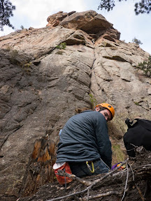
Our backpack would begin near the Boulder Airport in Utah. Airport security failed to confiscate our liquids (water and bourbon) and even more spectacularly failed to keep us off the runway.

I left Paul and our backpacks at a Starbucks near the international terminal (read: in the middle of nowhere) and drove a dozen miles down the highway to the Escalante River where I dumped his Jeep in the reeds and started to walk and hitchhike back up the road. A lovely lady from Holland traveling with two toddlers picked me up and cut my walking dramatically. My own country men couldn’t be counted on today to help a fellow out.

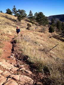
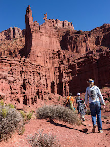
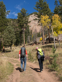
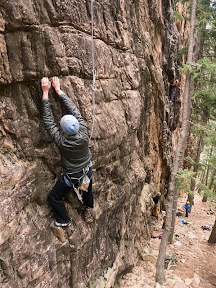
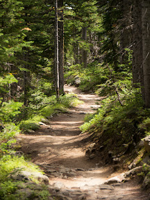
By noon we were clear for departure and started down the Boulder Mail Trail. Early pinion and juniper forest gave way to slick rock hiking as we neared the Sweetwater/Sand Creek drainage.

Somewhere around here we crossed paths with an old telegraph line which became fodder for many jokes at the expense of AOL forums.

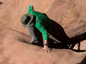
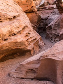
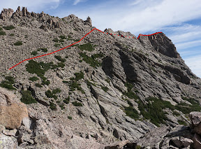
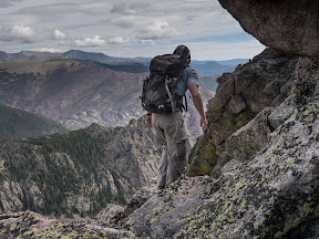
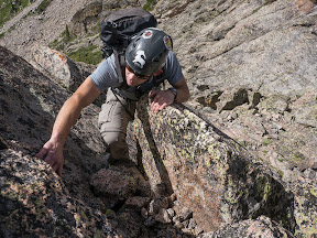
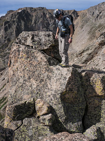
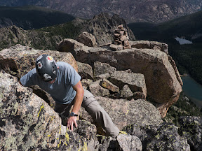
Before diving down into Death Hollow itself, we took a side trip up a stone knob for an amazing view into the upper canyon.

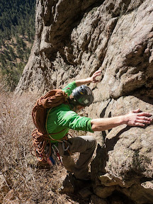
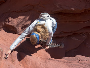
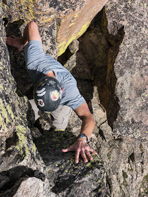
Back on the Boulder Mail Trail we followed it to a cairn placed on the edge of the earth, before following the carved out ledge that we carefully followed down into the canyon.

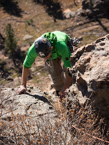
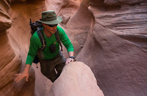
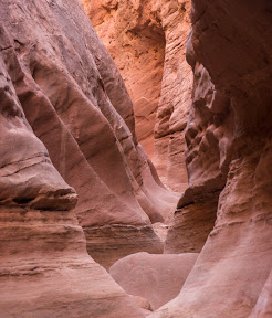
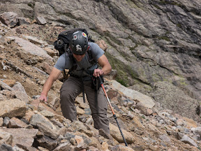
On the way down we passed two hikers, they’d be the last people to see us enter Death Hollow. We decided to skip the first campsite we saw and hunt for something better. The first of numerous creek crossings quickly came up so we switched to sandals and survived our Death Hollow initiation.

Luckily for us we located camp right at happy hour. Which meant the bourbon load would weigh less on our shoulders tomorrow. Which meant we could hike faster and eventually get back to civilization about the time the bourbon ran out. I love it when a plan comes together.

Normally I might sleep lightly in a canyon where flash flooding can be a major concern. However, our forecast looked clear and Paul assured me that his tent was rated for debris flow.

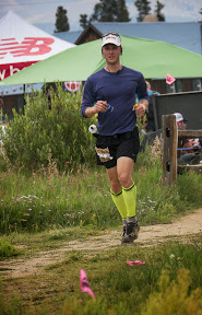
The next morning we woke looking forward to the highlight of the 3 day trip – our passage down Death Hollow through some narrows and beautiful scenery.

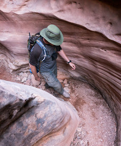
The temperatures were warm enough that we quickly stopped trying to rock hop across every bend in the stream, and took to wading liberally in the creek in our sandals and neoprene socks. A few long wading sections we discovered were due to beaver dams.

After quite a few creek crossings and much dodging of poison ivy we came to our deepest crossing of the day. I volunteered to scout it out sans-pack, and found the muddy water to be only mid-thigh deep. All our other crossings had been knee-deep or less so far.

Around noon we stopped for a lunch break somewhere – neither one of us had really been paying enough attention to the map to know exactly where we were at this point. Our navigation was pretty easy, just head downstream.

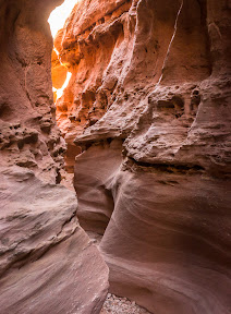
Shortly after lunch we did cross a big side stream which I figured was Mamie Creek. Below this point Death Hollow would get narrower and the rains from 2 weeks ago would decide just how hard our passage would be.

We’d already found a couple trash bags, tossed around in the recent flooding but surprisingly intact and filled with sand. We’d dug those out and packed them out like good LNT hikers. But when I came across two blue external frame packs that was a bit much to pack out. We could have helped our selves to a sierra cup and spork, but left those items with the pack thinking that scounging anything from this bounty would be bad juju.

The first real waterfall in the canyon soon presented itself, so I broke out the tripod and 10-stop filter for a long exposure.

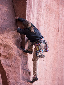
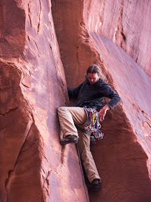
Half wading, half balancing on a narrow shelf we passed through the following narrows section.

We managed to get through without slipping into the deep pool of water and testing our dry bags.

Hiking the rest of the canyon was a little more enjoyable knowing we’d passed through the one area that could give us the most trouble already. And there was certainly plenty of Neature left in the canyon, including water snakes and water ouzels.

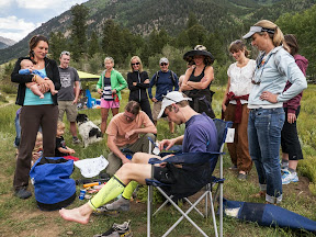
We hit the junction with the main Escalante perfectly for happy hour (this is becoming a habit). We found a perfectly flat campsite on a sandy bench surrounded by cottonwoods and investigated a nearby set of pictographs. We also madea point of pulling our drinking water from Death Hollow as it was much clearer than the muddy Escalante.

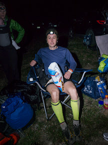
We may have been two days out and hadn’t seen another soul for more than 24 hours, but don’t let that fool you. There was certainly an element of glamping, after all, we had two fine bourbons to taste and Paul whipped up some salmon croquets for our dinner.

However, the glamping theme was a little put out by the wind and cold that came in as we cooked our croquets. And next morning’s cold wade across the Escalante for more of that Death Hollow water was bracing. But by 9am we were off and headed down canyon. Before too long we heard a chainsaw and came across a volunteer crew out removing invasive tamarisk trees from the canyon. The Escalante had also seen a lot of flooding two weeks ago and many debris piles had be to dodged as we bushwhacked between the creek and the higher banks.

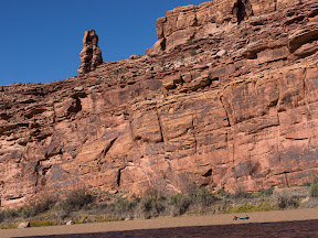
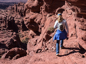
We ran into some day hikers just as we reached the significant landmarks of this stretch of the Escalante – the Escalante Natural Arch and Bridge and some Anasazi ruins.

After this trip and our spring visit to Grand Gulch we were starting to formulate our own theories of the Anasazi’s defensive cliff dwellings and sudden disappearance. I’ll share just two words with this readership while we wait for our peer-reviewed article to find a home in the appropriate scholarly journal: zombie apocalypse.

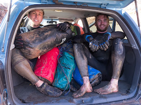
The last two miles were fraught with dangers as we had nearly emptied the last of our flasks and wondered if we could make the town of Escalante before going dry. Fortunately, Paul’s Jeep remained where I’d left it 2 days before and crisis was adverted.

Little Matterhorn

It had been too long since I’d done a proper scramble in the high peaks, but both Pete and I were getting over a week of sickness and we needed something not too long. Looking through Cooper’s “Colorado Scrambles” guide we decided on a hike and scramble to the “summit” of Little Matterhorn.

Bear Lake is a perennially crowded parking lot in Rocky Mountain National Park, but at 7:30am there were still plenty of spaces. The hike towards Odessa Lake allowed us to warm up and catch up on the last month. Before long we were headed off on an unmarked trail to Grace Falls, passing a group of 3 also bound for Little Matterhorn. From the falls we started the ugly part of the climb, a traversing ascent up a slope of unstable talus. The route we took definitely wasn’t optimal and required us to drop some hard won elevation as we tried to contour closer to our goal.

The climb up to the ridge from the point of the photo above was much more pleasant. The blocks where more stable and easier to scramble upon. Finally we hit the ridge and started in on the real joy.

Our initial attempt to stay on the ridge crest was quickly quashed and we detoured to the north side of the ridge to find a less extreme passage.

At the next notch we got back on the crest and mostly stayed there to the end.

The “summit” of this un-ranked peak is a step down from the ridge and involves the trickiest climbing of the day. To get down we squeezed through a chimney without packs. On the return trip we followed a crack system with great handholds but plenty of exposure.

A little worried about what the weather could bring, we hurried back along the ridge and then down the more stable blocks. Scouting the terrain from above we picked a lower line that had us traverse through the worst of the loose slopes to the grassy edges for an easier descent.

Once back at the falls it was an easy walk downhill to end a great hike and scramble.

Tara and I volunteered to help crew and pace Chris at his first 100 mile ultramarathon, the Leadville 100. The race started at 4am from the town of Leadville, an event we missed as we were still sleeping in another mountain town over the divide then. We easily found the Pipeline crew access point (2 miles north of the Half Pipe aid station – no crew allowed there) and met Brad and others crewing for Chris and soon our runner showed up.

He was in and out pretty quickly and our group packed up to head to the 40 mile point of the race at the town of Twin Lakes. There we setup on the edge of town with the gear we could haul to the site from a mile or so out of town, which was the closest we could park.

Chris came in looking good prior to the big climb up and over Hope Pass to the halfway point of the race.

He was a little disappointed that we didn’t have any of his pre-cooked tortellini for him saying “But I always eat tortellini when I climb over passes.”

Prepped with various non-tortellini foods, Skratch labs drink mix, clean socks and freshly bandaged blisters he headed out in good spirits.

Pacers are allowed for the second half of this race and Brad had already selected the soul-crushing climb back over Hope Pass from 50-60 miles to pace. Now that we were all gathered I organized the other pacers for the remaining 40 miles – Kristoffer, Tara, myself, Erin, and Michelle. Since I hadn’t really run in nearly 2 months since severely spraining my ankle I was hoping to get off with a small segment to pace. Due to the way schedules shook out, I ended up with the 10 mile leg between Outward Bound and May Queen aid stations that would involve a 2,000 foot climb up Powerline to Sugarloaf Pass. At least coming 3/4ths of the way into the race I figured Chris wouldn’t be moving too fast.

Brad, Tara and I quickly left Twin Lakes to drive around to Winfield not realizing what a traffic mess the roads around Winfield would be. With 2.5 miles still to drive to the aid station it was looking like we’d never get there in time to meet and pace Chris. So Brad and I loaded up a couple backpacks with food (including tortellini this time), clothes and water, plus Brad’s own gear to pace, and set out on a forced march up the dirt road. Tara eventually parked the car off the road and hiked in to join us as well. Chris came in looking a little worn out but Brad’s company soon brought him around and he passed many people going up Hope Pass on the return trip and threatened to outrun Brad. Tara and I scored a ride back down the 2.5 miles of road to our car then drove around to Twin Lakes, ate a bit of dinner and were soon surprised by an early arrival of Chris and a worn out Brad. Kristoffer took over pacing for the next 12 miles and the rest of us scattered to Pipeline or other more comfortable places to nap through the night.

At Pipeline I concentrated on eating and staying hydrated knowing my pacing leg was coming up and tried to catch a little sleep in the field as runners came through to meet their crews. Chris arrived feeling sluggish (the downhills were hurting him by now) and dehydrated. Tara had the next 3.5 miles to pace and force liquids on him while I drove ahead to Outward Bound and got ready to “run”.

Tara had done her job well and Chris had consumed 20 oz or so of water in the hour jog and hike to Outward Bound. There we put him in a chair with his legs up, got him to drink some broth and eat a bit of real food while he started to come around a bit more. In fact, by the time we left the aid station he was fairly chatty and I was able to keep up a conversation on ultras and other adventures as we motored up the steep and sandy Powerline trail to Sugarloaf Pass. Chris was able to eat and drink through this segment and even run some of the flats and gentle downhills on the way into May Queen. There Erin took over pacing and Tara and I fought to get out of the mess of a parking situation and tired crew members. We barely located and reached the Tabor boat ramp by the time Chris hiked the 6 miles there to give him his last opportunity to switch layers and access his gear. Michelle took him the final 6 miles into town for a ~28.5 hour 100 miler. As much as Tara and I would have loved to be there at the finish, we were simply too exhausted after pacing all night and found an empty gravel parking lot to throw some sleeping bags down and sleep for 3 hours as dawn arrived.

Chris’s performance was inspiring and motivating – I’d be lying if there wasn’t an ember in me now burning to train for another ultra next year.